DJI Mavic 3 Enterprise
DJI Mavic 3 Enterprise
SKU:
Couldn't load pickup availability
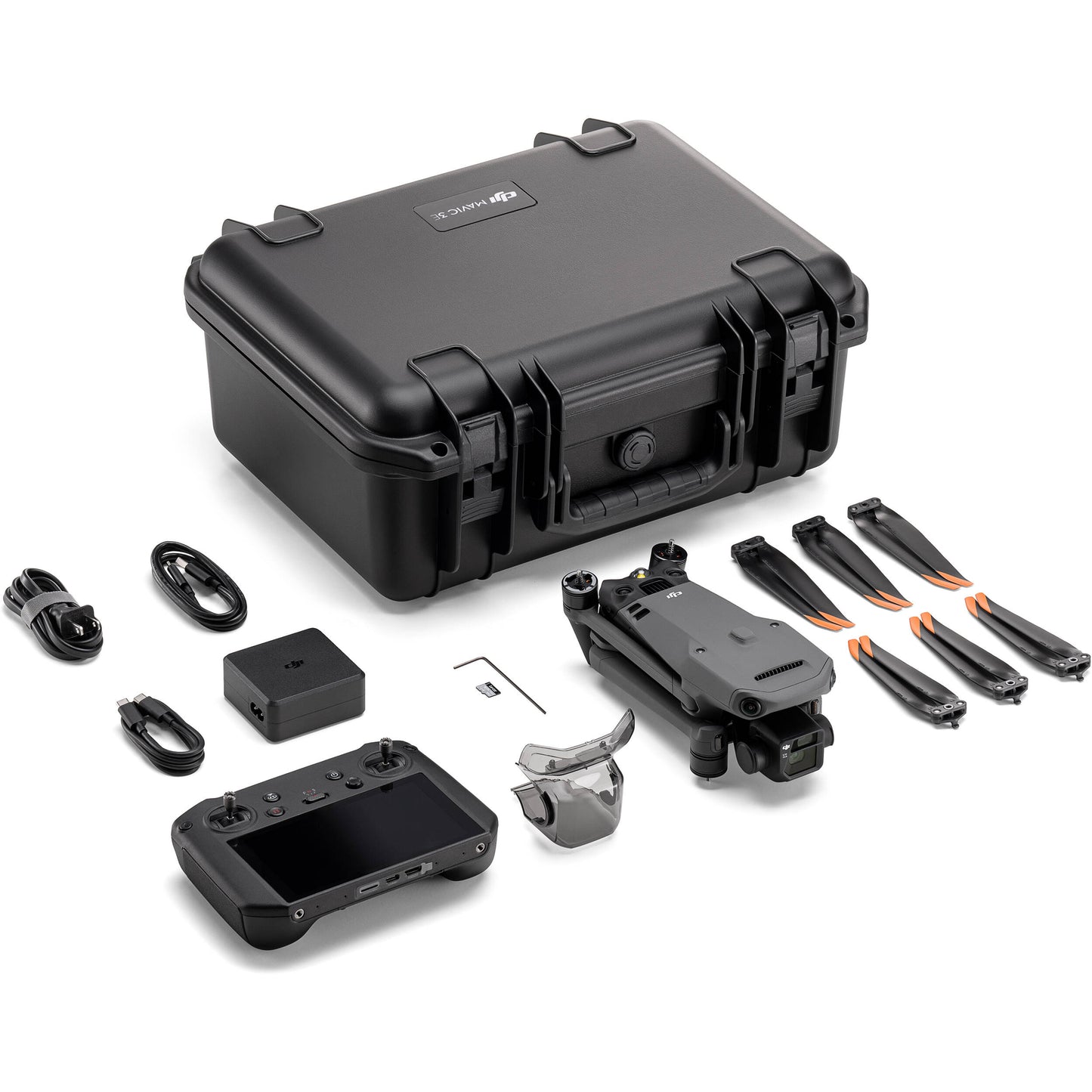
The DJI Mavic 3 Enterprise (M3E) is a compact, RTK-equipped mapping drone built for fast, accurate aerial surveys of farm operations. It features a 4/3 CMOS 20MP camera with a mechanical shutter for distortion-free imagery, alongside a 56x hybrid zoom camera for detailed visual inspection from a safe distance. With up to 45 minutes of flight time and centimeter-level positioning accuracy, the M3E can survey large acreages in a single flight while maintaining the precision needed for reliable mapping data.
For row crop operations, the M3E is a go-to tool for field boundary mapping, stand counts, drainage and erosion assessment, and scouting for storm or pest damage across large acreages. Its zoom camera lets operators inspect grain bins, equipment, irrigation systems, or hard-to-reach structures without putting boots (or ladders) involved. Paired with DJI Terra, captured imagery converts into orthomosaics and 3D models for record-keeping, insurance documentation, or planning input applications. It's a practical, versatile platform for growers and ag service providers who need reliable mapping and inspection without the cost or complexity of multispectral sensing.
Share