


Shopping with Rocoza Ag
New in the box
Every drone we sell is new in the box. Check the package details below for what’s included.
Shipping options
Free standard shipping or $150 express shipping to the contiguous 48 states. Alaska and Hawaii shipping is quoted separately.
Questions before you order?
Talk with our team about the right setup. Call 641-821-0532.
The new-in-box DJI Mavic 3 Multispectral combines RGB and multispectral imaging for crop scouting, field mapping and precision-agriculture workflows.
Highlights
- 20MP RGB camera with a 4/3-inch sensor and mechanical shutter
- Four 5MP multispectral cameras capture green, red, red-edge and near-infrared data
- RTK positioning supports precision mapping when suitable corrections are available
- Up to 43 minutes of flight time under DJI test conditions; actual flight time varies
- Use compatible software to create vegetation-index maps and support prescription-mapping workflows
What's included
- DJI Mavic 3 Multispectral aircraft with RTK module and microSD card
- Remote controller
- One intelligent flight battery
- Charger and power cable
- Three pairs of propellers
- USB-C cable and USB-C to USB-C cable
- DJI carrying case
More about the Mavic 3 Multispectral
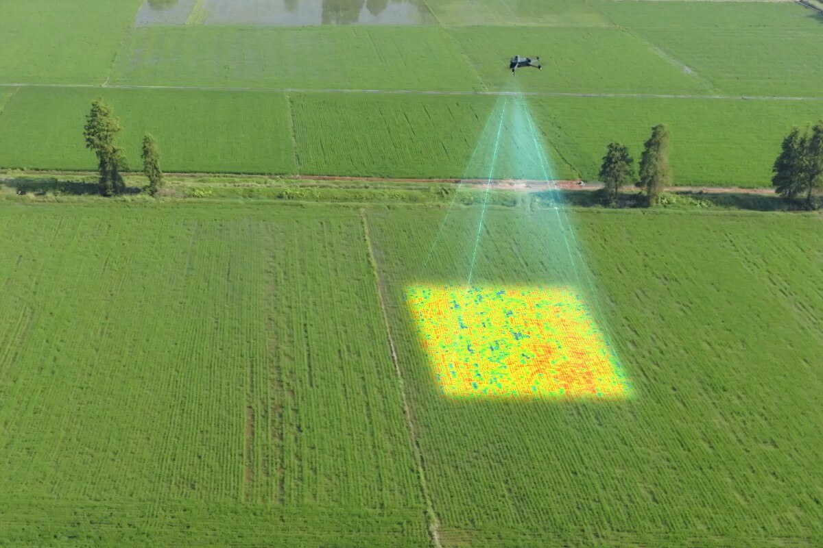
See variation across your fields
Multispectral imagery can be processed into maps such as NDVI to help identify areas for follow-up scouting. Variation may relate to factors such as nutrient availability, water stress, pests or disease, but a map alone cannot diagnose the cause.
Capture detailed visual imagery
The 20MP RGB camera and mechanical shutter capture visual imagery for mapping. Review field features alongside multispectral data to build a more complete view of your acreage.
Position your maps with RTK
The aircraft's RTK module supports precise positioning when a suitable correction source is available. Results depend on the correction source, flight conditions and processing workflow.
Plan fieldwork and application
With compatible processing software, use imagery to support variable-rate prescription maps for applications such as fertilizer, fungicide or irrigation. Results depend on field conditions and the tools and practices used.
Flight sensing assistance
Omnidirectional vision sensing assists with obstacle detection. Pilots remain responsible for safe flight, including accounting for lighting and environmental limitations.
Key specifications
- RGB camera: 20MP, 4/3-inch CMOS, mechanical shutter
- Multispectral cameras: four 5MP cameras, green, red, red edge and near infrared
- Positioning: RTK module
- Maximum flight time: up to 43 minutes in DJI test conditions
- Aircraft weight: approximately 951 g with propellers and RTK module
DJI measured flight time at sea level in windless conditions, at a constant 36 km/h until the battery reached 0%. Actual flight time varies. Follow return-to-home prompts and maintain a safe reserve.
Need additional flight batteries? Ask about the Mavic 3 Multispectral Fly More Kit, which includes four total batteries, a charging hub and a DJI case.
Questions? Call Rocoza Ag at 641-821-0532.
More Enterprise Drones
-
 Sold out
DJI Mavic 3 Multispectral
Regular price $4,618.00 USDRegular priceUnit price per -
 Sold out
DJI Matrice 4E Fly More Kit
Regular price $5,899.00 USDRegular priceUnit price per -
 Sold out
DJI Matrice 4E Enterprise Drone
Regular price $5,189.00 USDRegular priceUnit price per -
 Sold out
DJI Matrice 4T Fly More Kit
Regular price $7,699.00 USDRegular priceUnit price per


